A Challenging Summer
Pat Guinan
State Climatologist
Commercial Agriculture/University of Missouri Extension
Farmers this summer were presented with another challenging growing season as Mother Nature had plenty to offer in the form of extreme heat, severe drought, record flooding and severe thunderstorms.
An unusually warm air mass established itself over Missouri during the first ten days of June with oppressive heat impacting the state and several high temperature records being broken. Temperatures averaged 8-10 degrees above normal during the period and it was the hottest June 1-10 period since 1934. Springfield, Joplin and West Plains had their 6th, 4th and 4th hottest June on record, respectively.
Above normal rain fell during June across the northeastern half of the state with below normal precipitation occurring over southwestern sections. Some of the highest June rainfall totals occurred in Scotland, Lewis and Clark counties where the communities of Memphis, Monticello and Kahoka reported 13.29, 15.47 and 17.88 inches, respectively. Dozens of roads were flooded and cropland was inundated across the area. The Fox River, near Wayland, MO, reached record levels during this time. Alternatively, abnormally dry conditions were confined to far southwestern sections where several counties reported less than 1-inch for the month.
A different kind of flooding, induced by record reservoir release in the northern Plains, was impacting bottomland along the Missouri River. Numerous impacts were being felt, especially across northwestern Missouri, including flooded residences, closed roads and thousands of acres of inundated cropland.
During July a ridge of high pressure over the southern Plains intensified and expanded northeastward, bringing hot and dry conditions to Missouri and adversely impacting people, animals and vegetation. Missouri witnessed its hottest month in more than 30 years and it was the 6th hottest July on record. Southwestern Missouri experienced its fifth hottest July on record with crops and pastures taking a severe hit from the extreme heat. Springfield and Joplin, MO experienced 8 and 19 days, respectively, of triple digit heat. Hot temperatures and high humidity combined to produce very uncomfortable and life threatening conditions during the month.
Another feature of the prolonged heat wave was high minimum temperatures. The average July minimum temperature for most areas of Missouri was between 72-74°F. Many locations broke records for longest continuous string of minimum temperatures not dropping below 70°F. This occurred from mid July into the first week of August and induced crop stress, especially on corn, where it didn’t have an opportunity to “rest” at night.
Above normal summertime temperatures persisted throughout much of August, wrapping up another hot summer for the Show Me State. The hottest day of the summer occurred on August 2 when triple digit heat impacted much of the state. Numerous locations, especially across west central and southwestern sections, witnessed their hottest temperatures in more than 25 years. Some high temperature records include 108°F at Springfield and Columbia, 110°F in downtown Kansas City, as well as several locations in southwestern Missouri. The southwestern communities of Eldorado Springs and Protem reached 111° and 113°, respectively.
By the end of the August, moderate to severe drought conditions had evolved across northeastern Missouri, generally from St. Louis to the Iowa border. Some counties in far northeastern Missouri had transitioned from exceptional wetness to severe drought when less than 2-inches of rain fell between July and August. Persistent moderate to severe drought conditions continued to plague southwestern Missouri for the entire month of August. Flooding along the Missouri River persisted throughout the summer as upstream reservoir releases remained high during the period.
A notable and unusual severe weather event occurred across parts of northwestern Missouri during the evening of August 19th. A large supercell thunderstorm moved southeastward out of southwestern Iowa and impacted Nodaway, Gentry and Daviess Counties with 70-80 mph winds and quarter to golf ball sized hail. The storm caused widespread crop damage with reports of thousands of acres of flattened corn and completely defoliated soybean fields.
Preliminary numbers indicate average June-August temperatures for the state were slightly below 79°F, assuring its spot in the Top 10 for hottest summers on record in Missouri. The summer of 2011 will likely go down as the 7th hottest on record, slightly warmer than the summer of 2010.
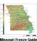
With summer over, and harvest season now in full gear, there’s always the concern for the first fall freeze. Most sections of the state will experience their first fall frost during October. Using climatology, the northern quarter of Missouri and eastern Ozarks will experience a light freeze (32° or cooler) as early as October 10 on 5 out of 10 years. Central Missouri and the western Ozarks will experience a light freeze on 5 out of 10 years by October 15. The Bootheel will have a light freeze on 5 out of 10 years by October 30. A map displaying the average date of first fall frost in Missouri can be found at the following web link: http://agebb.missouri.edu/weather/frost2.htm


