Climate of Missouri
Wayne L. Decker
Professor Emeritus
University of Missouri
Missouri has a continental type of climate marked by strong seasonality. In winter, dry-cold air masses, unchallenged by any topographic barriers, periodically swing south from the northern plains and Canada. If they invade, reasonably humid air, snowfall and rainfall result. In summer, moist, warm air masses, equally unchallenged by topographic barriers, swing north from the Gulf of Mexico and can produce copious amounts of rain, either by fronts or by convectional processes. In some summers, high pressure stagnates over Missouri, creating extended droughty periods. Spring and fall are transitional seasons when abrupt changes in temperature and precipitation may occur due to successive, fast-moving fronts separating contrasting air masses.
Missouri experiences regional differences in climates, but these differences do not have obvious geographic boundaries. Regional climates grade inconspicuously into each other. Nevertheless, several basic principles help to understand climatic differences in Missouri.
The basic gradient for most climatic characteristics is along a line diagonally crossing the state from northwest to southeast. Both mean annual temperature and precipitation exhibit gradients along this line.
TEMPERATURE - Because of its inland location, Missouri is subject to frequent changes in temperature. While winters are cold and summers are hot, prolonged periods of very cold or very hot weather are unusual. Occasional periods of mild, above freezing temperatures are noted almost every winter. Conversely, during the peak of the summer season, occasional periods of dry-cool weather break up stretches of hot, humid weather.
Temperatures over 100° F are rare, but they have occurred in every section of the State. In the summer, temperatures rise to 90° F or higher on an average of 40 to 50 days in the west and north and 55 to 60 days in the southeast. Temperatures below zero are infrequent, but have occurred in every county in Missouri. On the average there are 2 to 5 days a year with below zero temperatures in the northern counties, and 1 to 2 days in the southern counties, although there are some winters when temperatures do not go below zero at all.
Mean January minimum temperature follows the Northwest-to-Southeast gradient, from a low of 12° in the northwest to a high of 24° in the southeast. However, mean July maximum temperature shows hardly any geographic variation in the state. Mean July maximum temperatures have a range of only three or four degrees across the state (87° to 90°), and the central Ozarks averages somewhat cooler July temperatures than other portions of southern Missouri.
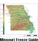
All of Missouri experiences freezing temperatures every year. In winter there is an average of about 110 days with temperature below 32° F in the northern half, the West Central Plains, and East Ozarks, about l00 days in the West Ozarks, and about 70 such days in the Bootheel counties. In northwestern Missouri, the average date (defined as 50 percent chance; as many freeze dates before as after the date), of the last spring moderate freeze (defined as temperatures in the range of 24-28°) is April 10. The average date of the first fall moderate freeze is October 25. In southeastern Missouri, the comparable dates are March 16 and November 20. Thus, the average length of the growing season by this liberal definition in northwestern Missouri is 198 days, and in southeastern Missouri it is 250 days. However, the date after which there is still a 20 percent chance of moderate freeze in spring (one freeze expected during a five-year period) in northwestern Missouri is April 20, and the date before which there is a 20 percent chance of moderate freeze in fall is October 15. In extreme southeastern Missouri, the comparable dates are March 26 and November 3. Thus the length of growing season for these probabilities of freeze is much shorter and is more likely to be used for agricultural crops. The length of the growing season by this definition drops to only 178 days in northwestern Missouri and 223 days in extreme southeastern Missouri. For both spring and fall, the higher elevation of the Ozarks interrupts the north-south gradient across Missouri. The growing season in the Ozarks is measurably shorter than in adjacent, lower regions.
The metropolitan areas of St. Louis and Kansas City exert a significant and measurable effect on their climates. Temperatures are elevated in both regions by a few degrees, an effect known as the �urban heat island.� More atmospheric particulates create a �dirtier� atmosphere of less intense light and a greater abundance of condensation nuclei. Somewhat cloudier skies and more hours of very light precipitation may result, although the total amount of precipitation may not be greater than in non-metropolitan areas.
PRECIPITATION - Mean annual precipitation varies along the same gradient as temperature, from a low of 34 inches in the northwest to a high of 50 inches in the southeast. Seasonal climatic variations are more complex. In northwestern Missouri, seasonality in precipitation is very pronounced due to strong continental influences. June precipitation, for example, averages five times greater than January precipitation. In contrast, in southeastern Missouri, seasonality in precipitation is insignificant due to the greater influence of subtropical air masses throughout the year.
Mean January precipitation varies along the gradient from a low of 0.8 inches in the northwest to a high of 3.6 inches in the southeast. However, mean July precipitation is greatest in northeastern Missouri, largely the result of high-intensity convectional precipitation (4.4 inches), and least in southwestern Missouri (3.2 inches). Though much less precipitation falls in northern Missouri in the winter than in the summer, it tends to be seasonally effective precipitation, since temperature and evaporation rates are much lower in winter.
Snow has been known to fall in Missouri as early as October, and as late as May. However, most of it falls in December, January, and February. As one would expect, the northern counties usually get the most snow. North of the Missouri River the winter snowfall averages 18 to 24 inches. This average figure tapers off to 8 to 12 inches in the southernmost counties. It is unusual for snow to stay on the ground for more than a week or two before it melts. Winter precipitation usually is in the form of rain, or snow, or both. Conditions sometimes are on the borderline between rain and snow, and in these situations freezing drizzle or freezing rain occurs. This does not usually happen more than five times in a winter season.
Spring, summer, and early fall precipitation comes largely in the form of showers or thunderstorms. Thunderstorms have been observed in Missouri during the winter months, but they are most frequent from April to July. Hail also occurs in all regions and may occur throughout the year, but it is much less likely in winter. May has the greatest number of days with hail. Measurable precipitation occurs on an average of about 100 days a year. About half of these will be days with thunderstorms. Occasionally, these produce some very heavy rains.
All of Missouri experiences "extreme" climate events, and such events must be considered part of the normal climate. Though infrequent in occurrence and often very geographically restricted, these �disturbances� produce environmental changes that may not otherwise have happened and that may be relatively long lasting in their effect. Among these extreme climatic events are high-intensity rains, protracted drought, heat waves and cold waves, ice storms, windstorms, and tornadoes. These climatic events, in turn, may lead to other environmental disturbances such as floods, fires, landslides, and abrupt changes in plant and animal populations and distributions. High-intensity precipitation characterizes all regions of Missouri. The town of Holt in northwestern Missouri holds the world record for a high-intensity rain, having received 12 inches within a 42-minute period on June 22, 1947. Once every two years in southwestern Missouri one should expect one precipitation event to produce at least 4.5 inches of rain in a 24-hour period. Over a five-year period, a ten-year period, a twenty-five-year period, a fifty-year period, and a hundred-year period one should expect one precipitation event to produce at least 5.5 inches, 6 inches, 7 inches, 8 inches, and 9 inches of rain respectively in a 24-hour period. Probabilities decline to the north and east away from southwestern Missouri. As expected, minimum-recorded temperatures are lowest in northern and western Missouri. The lowest temperature officially recorded in Missouri is -40° at Warsaw on February 13, 1905. Maximum-recorded temperatures are also highest in northern and western Missouri. The highest temperature officially recorded in Missouri is 118° at Warsaw and Union on July 14, 1954.
The river drainage in Missouri is wholly, either directly or indirectly, into the Mississippi River which forms the eastern boundary of the State. The northern part of the western boundary is formed by the Missouri River which then flows eastward across the State from Kansas City, entering the Mississippi just above St. Louis. Most of northern Missouri is drained by tributaries of the Missouri River, the principal ones being the Grand, Chariton, One Hundred and Two, and the Nodaway Rivers. The principal southern tributaries of the Missouri are the Osage and the Gasconade. Important tributaries which drain directly into the Mississippi within the borders of the State are the Fox, Wyaconda, Fabius, and Salt Rivers in the northeast, and the Meramec River which enters the Mississippi just below St. Louis. A small portion in the southwest corner of the State lies in the headwater area of some Arkansas River tributaries. A relatively small area in the south and southeast drains directly into the Mississippi outside the State through the White, St. Francis, and other minor streams.
Tributary flooding resulting from heavy rains and which may be expected once or twice in most years, and flash flooding along minor streams following heavy thunderstorm rains, occur most frequently in the spring and early summer, April to July, but may occur during any month. Serious flooding occurs less frequently along the main stems of the Missouri and Mississippi Rivers and usually occurs during the spring and early summer. Main stem flooding may be caused by prolonged periods of heavy rains, ice jams, or upstream flood crests synchronized with high tributary discharge. There are several flood control structures in the Missouri Basin above Kansas City, which may be expected to reduce upstream: flood crests in the future.
On the average the amount of water that falls in Missouri on a square mile in a year varies from near 600 million gallons in the northwest corner to over 800 million gallons in the southeast. This would be about 6 million gallons per person in some of the more thickly populated areas, and about 36 million gallons per person in some thinly populated sections. Some of this water runs off into the rivers and streams, some is consumed by animal life, and large amounts are evaporated back into the atmosphere, or transpired by growing vegetation. During years when precipitation comes in a fairly normal manner, moisture is stored in the top layers of the soil during the winter and early spring, when evaporation and transpiration are low. During the summer months the loss of water by evaporation and transpiration is high, and if rainfall fails to occur at frequent intervals, drought will result. Nearly every year some areas have short periods of drought in Missouri. There have been occasional years when the soil moisture has been depleted, arid when rains have failed to replace the water lost by evaporation and transpiration for prolonged periods. These conditions have caused widespread distress. With increasing population and more competition for the use of water, wise water management is becoming more important.
Drought may be conceptualized in different ways. Meteorological drought, based on precipitation records, is different from agricultural or soil-moisture drought and the physiological drought of plants. Drought is commonly thought of as a growing season phenomenon, but precipitation deficiency during colder months does affect moisture abundance during the following warmer months. If drought is defined as a month during which less than 40 percent of normal precipitation for that month is received, then the average probability of such a dry month, based on records at Columbia, is about 15 percent, or one in seven years. For the months of April and May, the probability reduces to 8 percent, but for August and September, it rises to 18 and 21 percent, respectively, or one in five years. Thus, monthly precipitation is more variable in August and September than in April and May. The probability of three consecutive months receiving less than 60 percent of mean precipitation, again at Columbia, for the months of April through October, is 13 percent, or about one year in eight. There is no convincing evidence that severe droughts occur in Missouri with any cyclic regularity. Drought directly affects plant and animal life by limiting water supplies, especially at times of high temperatures and high evaporation rates. Drought indirectly affects life by increasing plant and animal susceptibility to disease and the probability of fire and the severity of any fire.
An average of about 30 tornadoes (3.8 tornadoes per 10,000 square miles) are reported in the state each year. On the average, 8 of those tornadoes are strong/violent (F2-F5). Missouri ranks number 7 in frequencies, 12 in fatalities and, 9 in economic loss (based on all tornadoes between 1950 and 1994) in the nation. Tornadoes have been observed during every month of the year, with about 70 percent occurring during the 4 months, March through June. Over 25 percent (one in 4 years) of the total number are reported during May for the month of greatest frequency. Records indicate that only about 2 percent have occurred during August, an average of 1 in about 50 years, for the month of least activity. The highest death toll was also recorded during May, when nearly 53 percent of the total number of fatalities occurred. About 82 percent of the Missouri tornadoes occur between noon and midnight, with the greatest activity between 4 and 6 p.m. Paths of the Missouri tornadoes are usually short, averaging only 9-1/2 miles. The width of tornado paths averages slightly less than 300 yards. Tornadoes have been reported during each year.
Superimposed upon the basic statewide climatic patterns are local topographic influences that create topoclimatic, or microclimatic variations. In regions of appreciable relief, for example, air drainage at nighttime may produce temperatures several degrees lower in valley bottoms than on sideslopes. At critical times during the year, this phenomenon may produce later spring or earlier fall freezes in valley bottoms. Fog, heavy dew, and higher humidities are more common in low-lying areas. Deep sinkholes often have a microclimate significantly cooler, moister, and shadier than surrounding surfaces, a phenomenon that may result in a strikingly different ecology. Microclimate is also expressed by different wind speeds due to differences in the exposure of surfaces such as bluff faces. Higher daytime temperatures of bare rock surfaces and higher albedo (reflectivity) of unvegetated surfaces may create distinctive environmental niches such as glades and balds. Slope orientation (direction) is an important topographic influence on climate. South-and-west-facing slopes are regularly warmer and drier than adjacent north- and-east-facing slopes. Finally, the climate within a canopied forest is measurably different from the climate of adjacent open areas where most standard weather stations are located.
The length of daylight in Missouri (including refraction of sunlight), at latitude 39° north (approximately Columbia), varies from a low of 9 hours and 26 minutes on the December solstice to a high of 14 hours and 55 minutes on the June solstice. Thus, the annual range of length of daylight between the two solstices is approximately 5 1/2 hours. Comparable figures for latitude 36°30' north (Missouri-Arkansas state line) are 9 hours and 40 minutes and 14 hours and 30 minutes, an annual range of less than five hours. Comparable figures for latitude 40°30' north (approximately the Missouri-Iowa state line) are 9 hours and 17 minutes and 15 hours and 4 minutes, or an annual range of just less than 6 hours.
The various combinations of climate, terrain, and soil in Missouri have made possible several major types of farming. In the prairies of northern and west-central Missouri a combination of grain and livestock is most common. In the Ozarks, a large forest products industry is developing. Farms in the Ozarks are usually small and quite varied in their products. In the southwestern counties there are numerous dairy, fruit, and vegetable-producing areas. The rich deep soil, abundant rain, and warm temperatures of the Bootheel section in southeastern Missouri have made possible a highly intensive kind of farming. Major crops are cotton, corn, and soybeans. This area produces a large share of the cash value of all crops in Missouri each year.
The Ozark region gets abundant rainfall in an average year, and has numerous streams and many springs. Several large lakes have been created by damming up streams, and these are becoming centers for a rapidly growing tourist and vacation industry, besides providing electric power and flood control. In the northern counties, underground water is not as readily available as in other sections. More use is being made of small dams and farm ponds to impound surface water during seasons with abundant rainfall.


