October 2021 Weather and Its Impacts on Missouri
Pat Guinan
State Climatologist
University of Missouri Extension
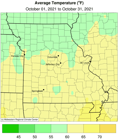
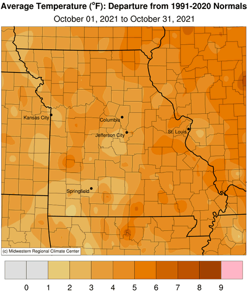
Preliminary data indicate the statewide average October temperature was 60.6°F, or 3.6° above the long-term average. It was the warmest October since 2016, Figure 1. It was also the sixth above average month for the year and third consecutive month with above average temperatures, Figure 2.
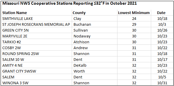
Warm conditions dominated the first 3 weeks of the month with high temperatures on many days reaching the 70s, Figure 3. Most of Missouri typically experiences its first fall freeze in October, Figure 4, but this year only a handful of locations in northwestern Missouri and the eastern Ozarks reported temperatures ≤32°F, Table 1. Fall freezes occurring later than usual has been the trend over the past 20 years, Figure 5.
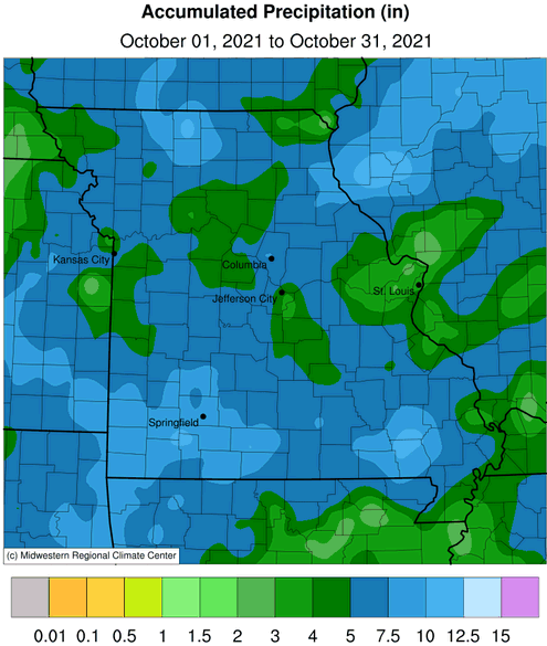
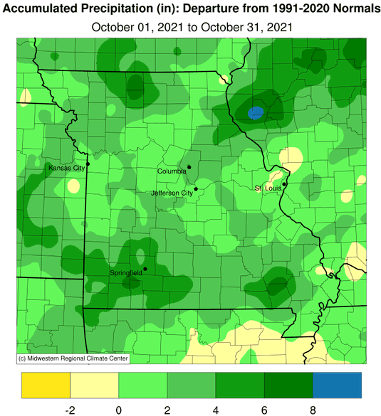
The statewide average preliminary precipitation total for October was 6.11 inches, or 2.92 inches above the long-term average. It was the 5th consecutive October with wetter than average conditions and the wettest October since 2014, Figure 6. It also ranked as the 8th wettest October on record. There have been 7 wetter than average months this year, Figure 7.
According to radar estimates, most locations reported more than 5-inches for the month with scattered pockets of 3-5 inches elsewhere, Figure 8. Lightest radar estimates were found in east central Missouri, around the St. Louis metropolitan area. The highest mean county rainfall estimate for the state was in Mercer County with 9.87 inches. St. Louis County and St. Charles County both reported the lowest total of 3.33 inches.
Occasional wet periods limited opportunities for crop dry-down and fieldwork activity, but favorable September weather had given producers a head start on harvest. According to the Missouri Agricultural Statistics Service, for the week ending October 31, corn and soybean harvest was 86% and 59% complete, respectively; 4 percentage points ahead of the 5-year average for corn and 2% points behind the 5-year average for soybean. The majority of topsoil and subsoil moisture conditions were reported adequate at 80% and 83%, respectively. Hay supplies were mostly adequate (87%) to surplus (4%) with only 8% reported short to 1% very short. Stock water supplies were mostly adequate (92%).
Wet and warm October conditions mitigated livestock winter feed supply concerns with robust cool season grass growth reported. The U.S. Drought Monitor also indicated improving conditions by the end of the month, with residual pockets of dryness, Figure 9.
An unusual fall tornado outbreak occurred on October 24, Figure 10. Surveys performed by the National Weather Service documented 15 tornadoes. Fortunately, no significant injuries or fatalities were reported with the storms. Two EF-3 tornadoes were reported in southeastern Missouri with estimated peak winds of 150 mph.
Jump to:
- Figure 1
- Figure 2
- Figure 3
- Figure 4
- Figure 5
- Figure 6
- Figure 7
- Figure 8
- Figure 9
- Figure 10
- Figure 11
- Figure 12
- Figure 13
- Figure 14
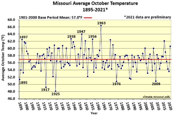
Figure 1.
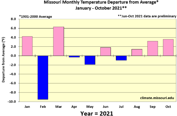
Figure 2.
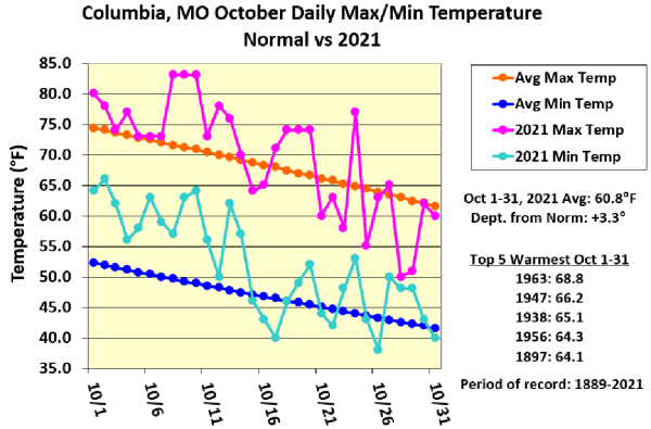
Figure 3.
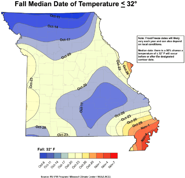
Figure 4.
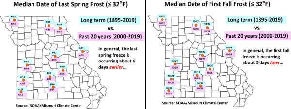
Figure 5.
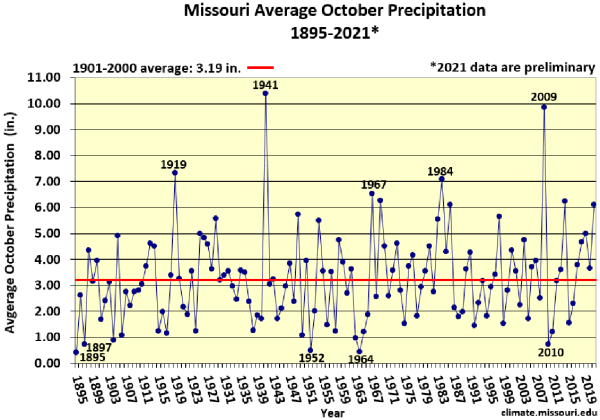
Figure 6.
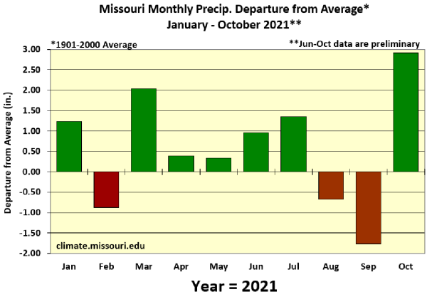
Figure 7.
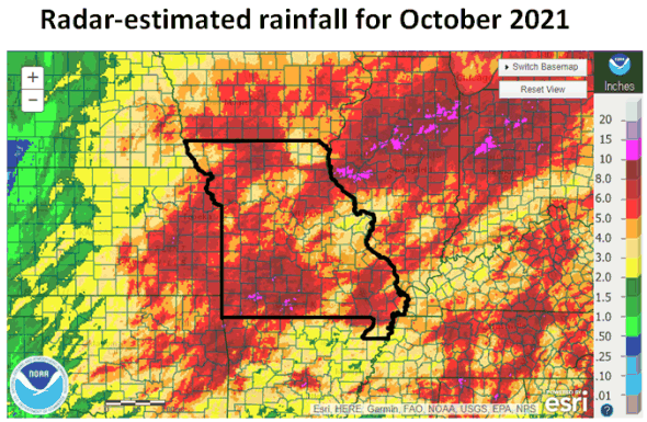
Figure 8.
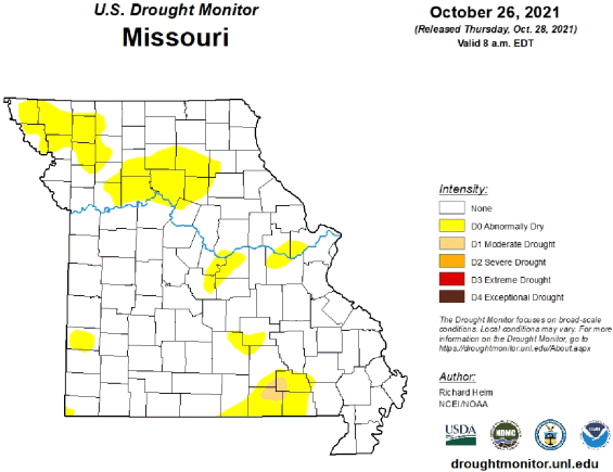
Figure 9.
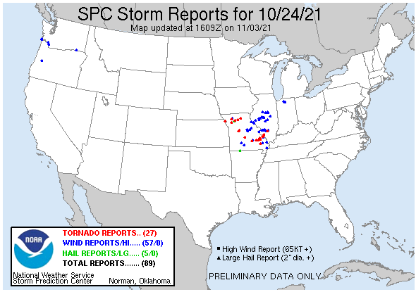
Figure 10.
Source: Pat Guinan, 573-882-5908


