October 2016 Weather and Its Impacts on Missouri
Pat Guinan
State Climatologist
Commercial Agriculture/University of Missouri Extension
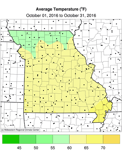
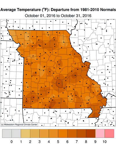
Unusually mild weather impacted Missouri during October with preliminary data indicating a statewide average temperature of 62.1°F, slightly more than 5 degrees above normal and the warmest October in more than 4 decades (1971), Figure 1. It was the 8th warmest October on record, and the 9th month with above average temperatures for 2016, Figure 2. The extended 2016 warmth resulted in the 4th warmest Jan-Oct period for Missouri since 1895, Figure 3.
Using Columbia, MO as a midpoint for the state, daily temperatures remained above normal for much of October, with only a handful of days reporting slightly cooler than average conditions, Figure 4. Record to near record warmth occurred around the state mid-month when temperatures climbed into the upper 80's and lower 90's.
It was the warmest Sep-Oct period for the state since 1963, and freezing temperatures had not occurred for many locations this fall. These conditions translated to warm season grasses still growing and remaining green. Autumn colors were also slow to emerge and leaves remained intact on most shrubs and trees at the end of October. Only a few locations across northern Missouri reached the lower 30's during the second and third week of October. Median autumn dates for light (≤32°F), moderate (≤28°F) and hard (≤24°F) freezes in Missouri can be found at the following link: http://ipm.missouri.edu/FrostFreezeGuide.
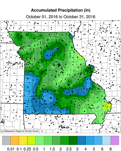
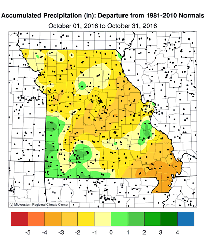
With few exceptions, much of the state reported below normal rainfall during October. Preliminary data indicate the average statewide total was 2.30 inches, or just under 1-inch below normal. It was the second consecutive October with drier than average weather, Figure 5, and first dry month this year since June, Figure 6.
The dry October conditions hastened harvest and fieldwork activity around the state. Corn and soybean harvest was running ahead of schedule and crop dry-down opportunities were numerous. According to the Missouri Agricultural Statistics Service, corn and soybean harvest was 92% and 73% complete, respectively, by October 30. That's 5% ahead of the 5-year average for both crops. The majority of topsoil and subsoil moisture conditions were reported adequate at 72% and 81%, respectively. Pasture and stock water supplies were also mostly adequate at 89% and 90%, respectively. The Drought Monitor map as of November 1 indicated a few pockets of abnormally dry conditions and moderate drought impacting eastern portions of the Bootheel, Figure 7.
According to monthly precipitation reports, lowest total October rainfall occurred in Mississippi county where a CoCoRaHS observer west-northwest of Anniston reported 0.27", and an automated rain gauge 5 miles south of Charleston received a paltry 0.19" for the month. A few southwestern counties, especially along the Missouri-Kansas border, from Bates to Newton counties, reported some of the heaviest monthly rainfall with 5-6 inches.
Jump to:
- Figure 1
- Figure 2
- Figure 3
- Figure 4
- Figure 5
- Figure 6
- Figure 7
- Figure 8
- Figure 9
- Figure 10
- Figure 11
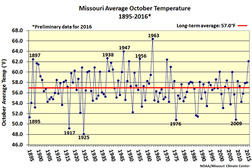
Figure 1.
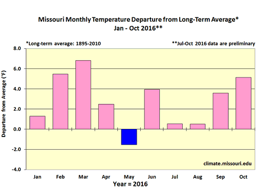
Figure 2.
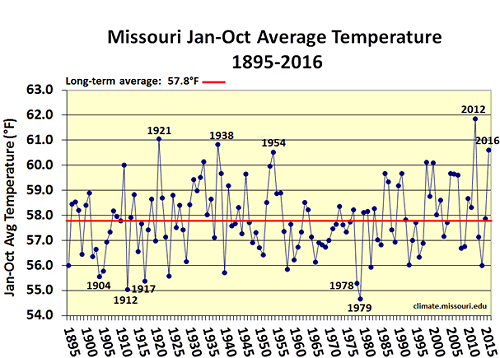
Figure 3.
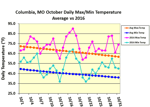
Figure 4.
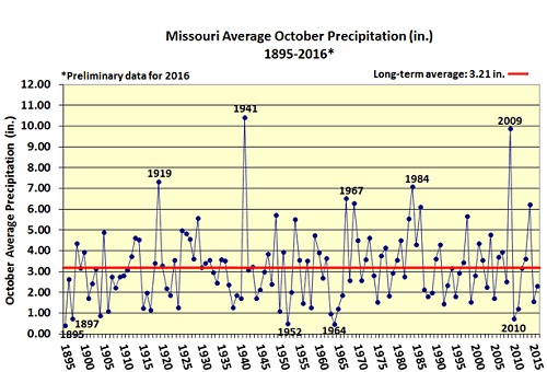
Figure 5.
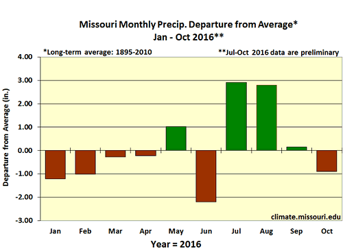
Figure 6.
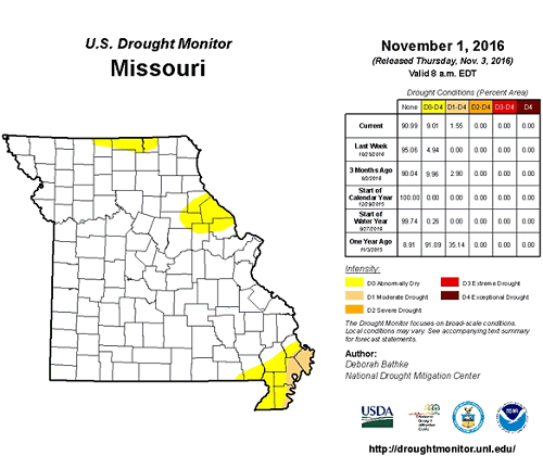
Figure 7.
Source: Pat Guinan, 573-882-5908


