October 2012 Weather and Its Impacts on Missouri
Pat Guinan
State Climatologist
Commercial Agriculture/University of Missouri Extension
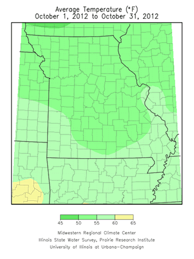
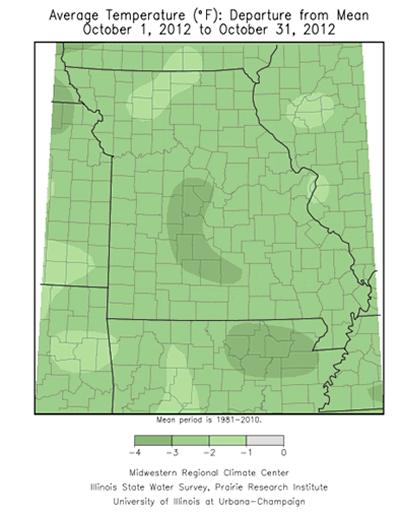
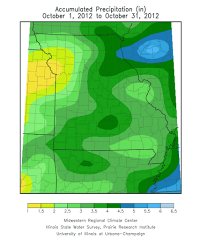
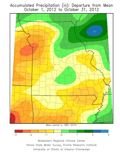
Varying periods of warm and cool weather occurred during October, but preliminary data indicates below average temperatures and near average rainfall were the rule across the Show Me State. The statewide average temperature was slightly less than 3°F below the long-term average of 57°F. Precipitation varied across Missouri, but the statewide average total was slightly more than 3-inches, close to the long-term average for October.
Topsoil moisture conditions improved across southwestern, south central and northeastern sections where near to above normal rainfall totals of 3.5-6.0 inches were common. Some of the heaviest monthly totals were witnessed in Greene County, around the Springfield area, where more than 7-inches were reported for the month. Below normal October rainfall occurred over northwestern, west central and a few southeastern counties, where less than 2-inches were reported for October. Some of the lowest monthly precipitation totals were north of the Kansas City area, in Platte and Clay counties, where just over 1-inch of rainfall was reported.
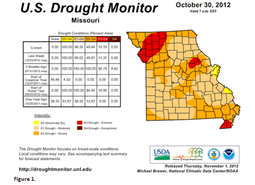
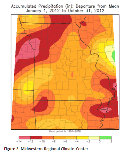
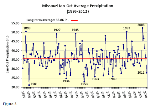
Occasional rain events, cooler temperatures and the lack of any widespread killing freeze for most of October allowed vegetative growth and green-up of lawns and pastures across the state. However, long-term drought conditions remained, with various levels of dryness impacting all of Missouri (Figure 1). Year-to-date deficits were impressive, with portions of northwest and far southeastern Missouri accumulating deficits greater than 10-inches (Figure 2). Statewide average January-October precipitation was just under 28 inches, nearly 8-inches below, and the driest period since 1988 (Figure 3). Significant surface water recovery was especially notable over southwestern sections where more than 10 inches of rain fell between September-October.
Even though overall drought conditions have improved across Missouri this fall, a complete recharge of water resources above and below the ground was not realized by the end of October. According to the October 28th, 2012 Missouri Agricultural Statistics report, 46% of topsoil moisture in the state was in short to very short supply, and 79% of the subsoil moisture supply was reported short to very short. Additionally, 78% of the stock water supplies were reported to be in short to very short supply and 60% of the pastures were in poor to very poor condition.
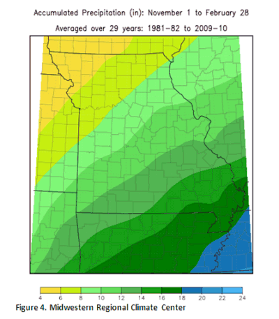
The highest likelihood for hydrological drought to carryover into next year exists across northwestern Missouri, where a significant precipitation deficit remains and precipitation is climatologically the lightest between November and February (Figure 4). Normal Missouri precipitation during the period ranges from 4-6 inches in the northwest corner to 16-18 inches in the Bootheel.