April 2024 Weather and Its Impacts on Missouri
Dr. Pat Guinan |
Dr. Zachary Leasor |
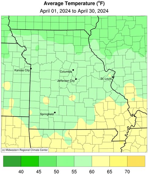
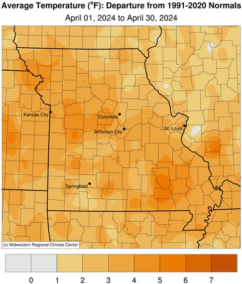
There were alternating periods of above and below normal temperatures during April in Missouri, Figure 1, but an unusually warm week during mid-month translated to a notably warmer than average month, Figure 2. It was the 13th warmest April on record out the past 130 years and the warmest April since 2012. Preliminary data indicate a statewide average temperature of 58.6 °F, 4.1 degrees above the long-term average. Since January 2023, only one month has been below average, Figure 3.
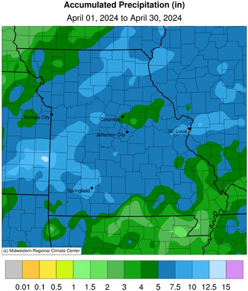
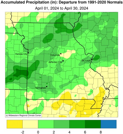
Many areas in Missouri experienced wetter than average April conditions. Preliminary data indicate a statewide precipitation total of 5.69 inches, 1.72 inches above the long-term average. It was the wettest April since 2017, and 14th wettest April on record, Figure 4. It was also the second wetter than average month for the year, Figure 5.
April precipitation totals were lightest across far southeastern sections and the northwestern corner of the state where 3-5 inches were common. Totals across much of much of the rest of the state were between 5-7.5 inches. Heavier pockets, between 7.5-10 inches, were in southwestern, west central, north central and northeastern Missouri.
Drought conditions improved over most areas of the state in April, but there were exceptions where rainfall was not as plentiful. Dryness intensified over parts of far southeastern and far southwestern Missouri according to the U.S. Drought Monitor from April 30, 2024, Figure 6.
According to the Missouri Agricultural Statistics Service, for the week ending April 28, corn planting was 63% complete, 23 percentage points ahead of the 5-year average. Stock water and hay supplies were reported mostly adequate at 79%, and 71%, respectively, but 29% of the hay supplies and other roughages were in short to very short supply. Most of the pastures were in good condition, at 58%. Topsoil and subsoil moisture supplies were mostly adequate at 71% and 68%, respectively, but a sizeable percentage of subsoil was in short (19%) to very short (4%) condition due to the antecedent long-term drought conditions.
For the second time in less than seven years, a total solar eclipse impacted a portion of Missouri. During the afternoon of April 8th, the path of totality swept northeastward across a section of southeastern Missouri, Figure 7. Sky conditions cooperated and the breathtaking phenomenon did not disappoint, Figures 8-14.
Jump to:
- Figure 1
- Figure 2
- Figure 3
- Figure 4
- Figure 5
- Figure 6
- Figure 7
- Figure 8
- Figure 9
- Figure 10
- Figure 11
- Figure 12
- Figure 13
- Figure 14
- Figure 15
- Figure 16
- Figure 17
- Figure 18

Figure 1.
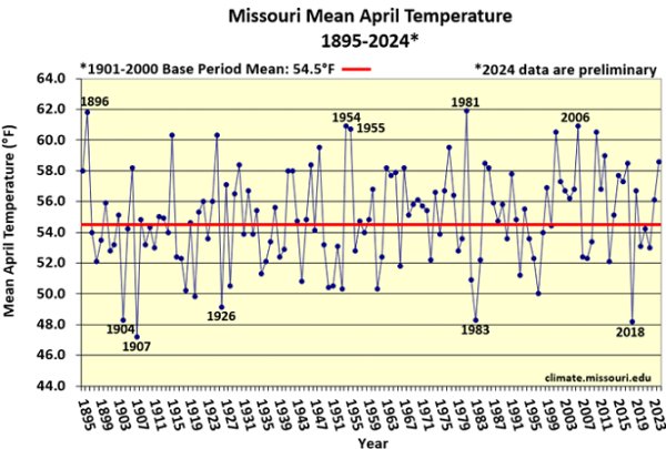
Figure 2.
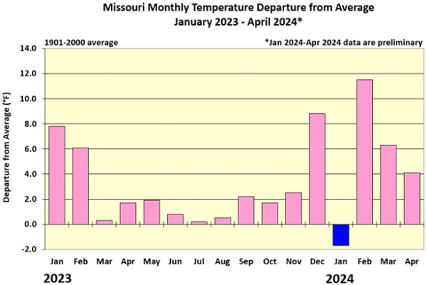
Figure 3.
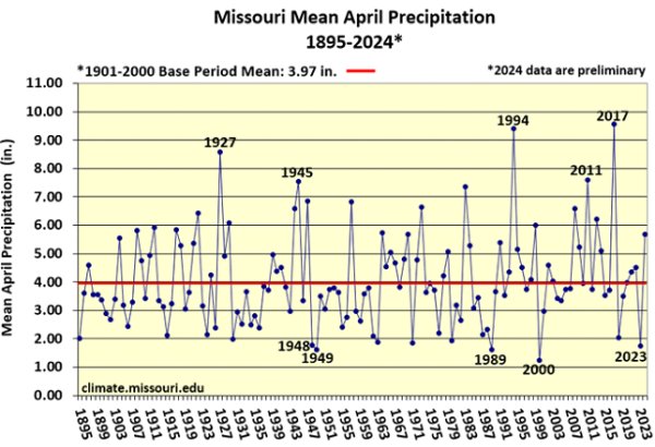
Figure 4.
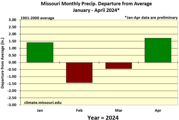
Figure 5.
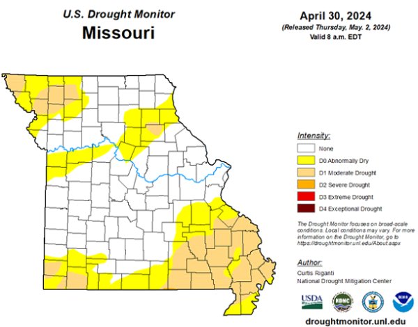
Figure 6.
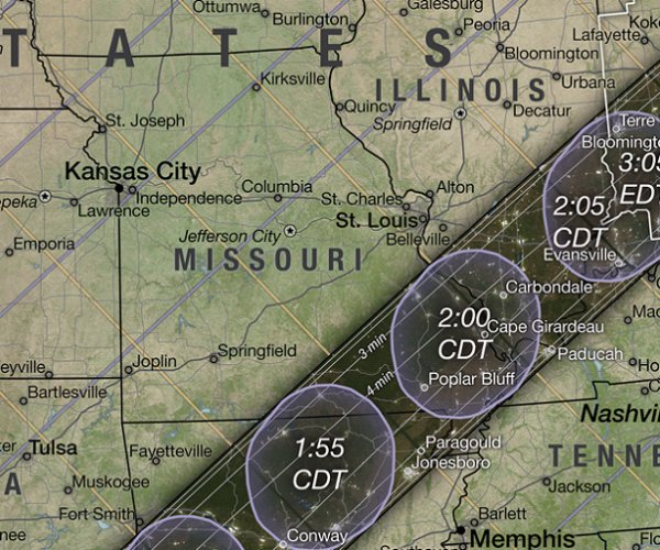
Figure 7. NASA map showing path and timing of the solar eclipse
over Missouri, April 8, 2024.
Source: NASA's Scientific Visualization Studio
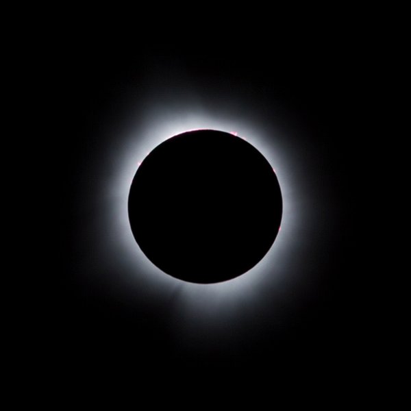
Figure 8. Sedgewickville, Bollinger County, Missouri, April 8, 2024.
Photo credit: Nicolas Bohorquez
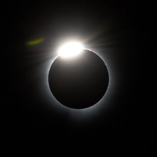
Figure 9. Sedgewickville, Bollinger County, Missouri, April 8, 2024.
Photo credit: Nicolas Bohorquez
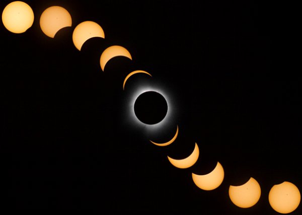
Figure 10. Sedgewickville, Bollinger County, Missouri, April 8, 2024.
Photo credit: Nicolas Bohorquez
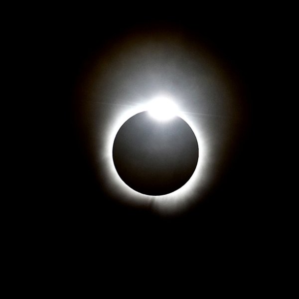
Figure 11. Taum Sauk Mountain, Iron County, Missouri, April 8, 2024.
Photo credit: Patrick Hayden
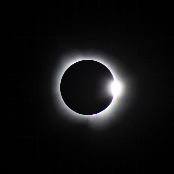
Figure 12. Taum Sauk Mountain, Iron County, Missouri, April 8, 2024.
Photo credit: Patrick Hayden
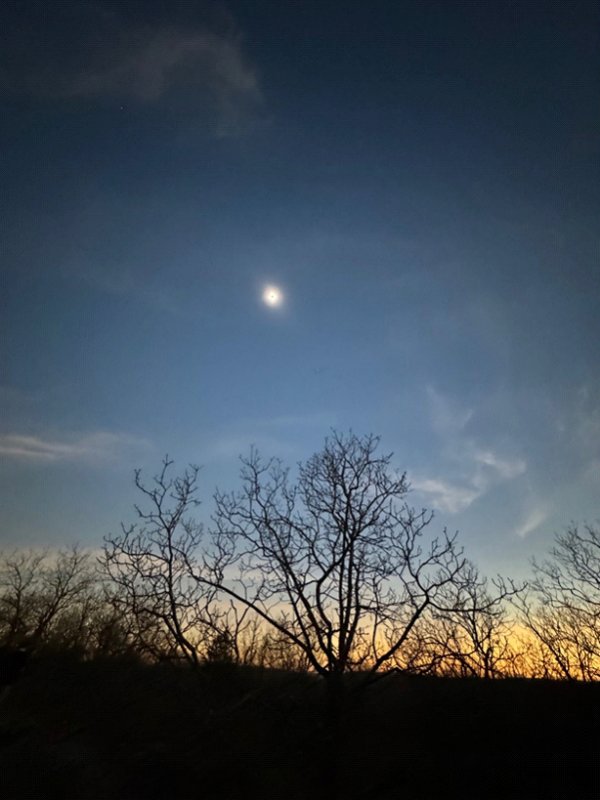
Figure 13. Taum Sauk Mountain, Iron County, Missouri, April 8, 2024.
Photo credit: Gracye Allen
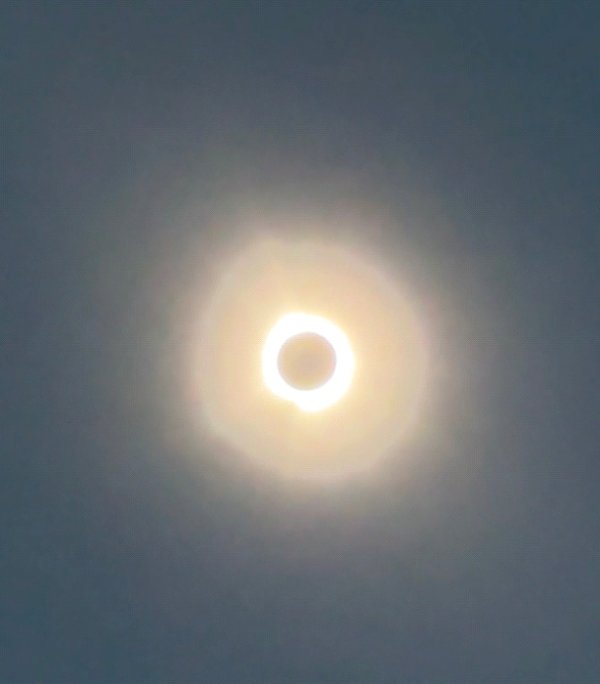
Figure 14. Taum Sauk Mountain, Iron County, Missouri, April 8, 2024.
Photo credit: Gracye Allen
Source: Dr. Pat Guinan and Dr. Zack Leasor | 573-882-5908


