April 2012 Weather and Its Impacts on Missouri
Pat Guinan
State Climatologist
Commercial Agriculture/University of Missouri Extension
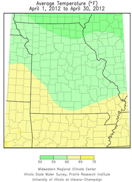
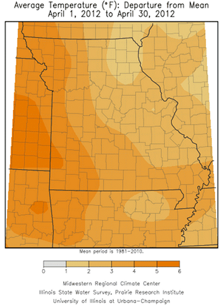
The mild weather regime continued into much of April for Missouri, making it the 7th consecutive month with above normal temperature for the Show Me state. In fact, the October through April period is the warmest on record for the Missouri, surpassing the previous mild period record set from October 1931 through April 1932. Preliminary data from Missouri indicated April temperatures averaged 3 degrees above normal for the state. Regional temperatures averaged 2-3° above normal across the eastern half of Missouri and 3-4° above normal across the western half of the state.
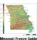
The record warmth experienced in March created significant cause for concern of potential freeze damage to sensitive vegetation that was growing 3-4 weeks ahead of normal. Freezing temperatures are common in April, the median date for the last 32° temperature ranges from the 3rd week of April in northern sections and the Ozarks, to mid-April in central Missouri, and the first week of April in the Bootheel. Fortunately, there were no widespread killing freezes in Missouri this year, unlike the devastating 2007 Easter Freeze.
However, there were reports of regional freeze damage across portions of northern and eastern Missouri when temperatures dropped on two consecutive mornings (4/11-12) into the upper 20's and lower 30's. Another pair of chilly mornings on 4/21 and 4/23 brought temperatures hovering around 32°F over parts of northern Missouri and the Ozarks region, especially in more vulnerable low lying areas where cold air drains and pools. There were scattered reports of damage to early planted corn and fruit crops, notably freeze sensitive grapes.
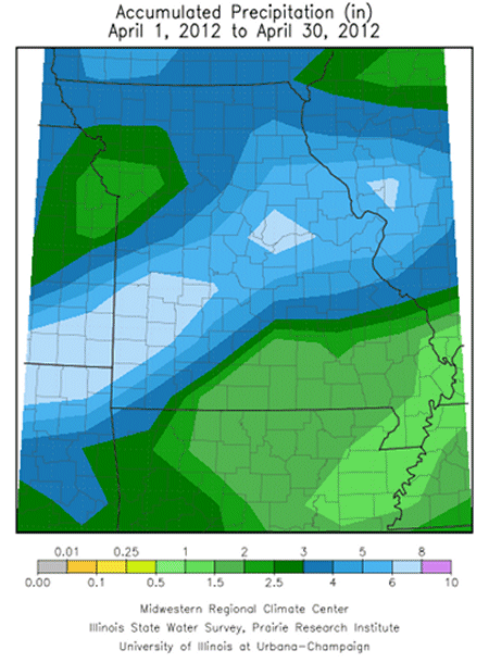
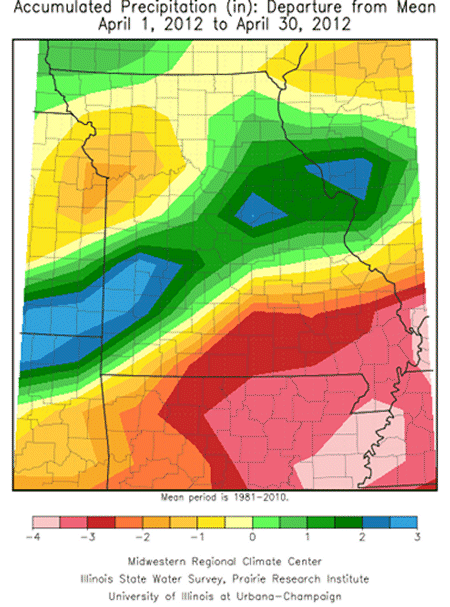
April precipitation was variable across the state, but slightly below normal, averaging just below four inches statewide. Monthly totals averaged 2.5-4.5 inches across northern sections and 1.5-3 three inches over west central and southeastern Missouri. Some counties in south central Missouri were dry, reporting 1-2 inches for the month. Abnormally dry conditions had evolved over the Bootheel region where less than 1.5 inches had been reported in many locations. Some of the driest parts of the state were in the Bootheel, where Anniston and New Madrid, MO reported 0.80" and 0.61" for the month, more than 4 inches below normal. A 100-mile wide corridor of above normal rainfall extended along and north of the I-44 corridor, from Joplin to St. Louis. Reports ranged from 5-9 inches, with St. Louis, Columbia, and Nevada reporting 7.30, 8.05 and 9.15 inches, respectively.
A couple notable severe weather events occurred during the month when severe thunderstorms impacted Clark county, in extreme northeastern Missouri, and the St. Louis metropolitan area. A supercell thunderstorm moved from southeast Iowa into far northeast Missouri on the evening of April 25 and impacted Clark county with an EF-1 tornado that traced a 1-mile long path of damage, mostly to rural property. The same storm also caused hail damage to crops and to the community of Kahoka, MO, where golf ball sized hail damaged roofs, cars and windows.
Strong winds and hail as large as softballs swept through the St. Louis area on April 28, resulting in power outages and substantial tree, residential and vehicular damage. A beer tent, full of patrons, was blown from its moorings when a strong gust of wind occurred in downtown St. Louis, killing one and injuring several people. Numerous rental car companies in and around St. Louis Lambert Airport were unable to book reservations due to hail damage to their fleets, and as many as 50,000 cars in the St. Louis area were damaged.
Mild and dry periods occurred during the month, providing opportunities for planting. According to the Missouri Agricultural Statistics Service, 75% of the corn was planted toward the end of the month, which is 3 weeks ahead of normal.
