
February 2023 Weather and Its Impacts on Missouri
Pat Guinan
State Climatologist
University of Missouri Extension
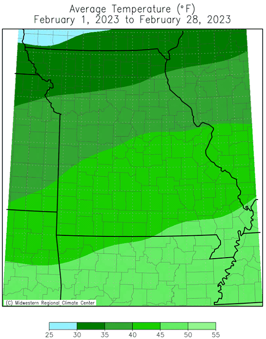
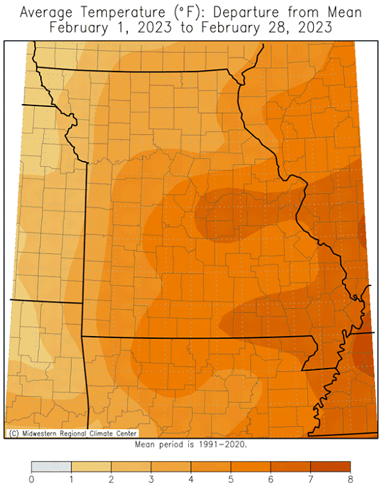
Mild February temperatures were dominant in Missouri with only a handful of days when maximum and minimum temperatures dipped below average, Figure 1. Preliminary data indicate the average statewide temperature for February was 40.0°F, 6.2 degrees above the long-term average (1901-2000). It was the first above average February in three years, and ranked as the 14th warmest February on record, tying with 1938, Figure 2. Nine out of the past twelve months have been warmer than average, Figure 3.
The first two months of the year in Missouri were unseasonably warm, ranking as the 4th warmest Jan-Feb period in the past 126 years, or 7.0 degrees above average, Figure 4. It was the warmest Jan-Feb since 2017.
Preliminary data for meteorological winter (Dec-Jan-Feb) indicated an average temperature of 39.6°F, or 4.6 degrees above average. It was the 10th warmest winter on record for Missouri, Figure 5. Mild winters have been the trend for Missouri over the past few decades. Eight out of the ten warmest meteorological winters in Missouri have occurred since 1991-1992.
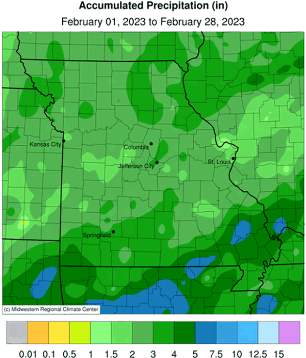
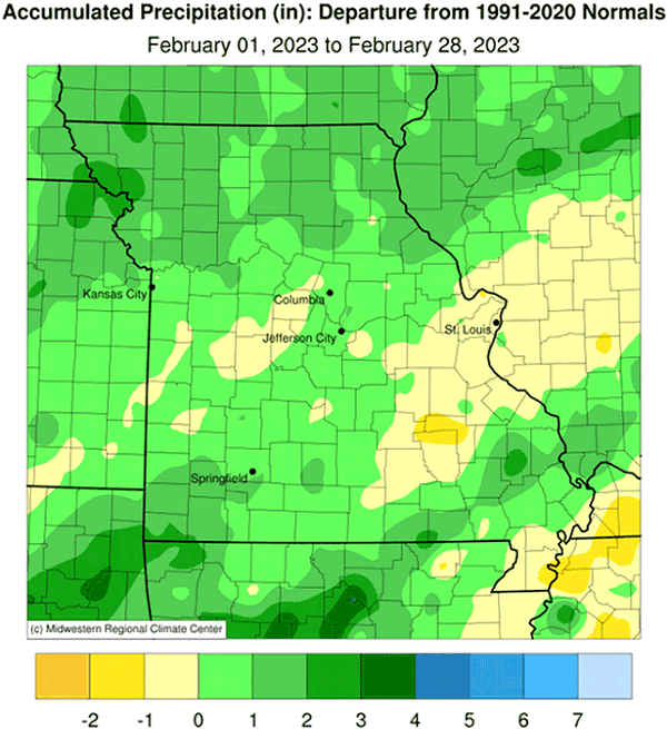
Preliminary precipitation data indicated a statewide average monthly total of 2.86 inches, or 0.84 inches above the long-term average. Five out of the past six Februaries have been wetter than average, Figure 6. Three out of the past four months have been wetter than average for the state, Figure 6.
Most locations experienced above average precipitation except for a few areas in central, east central and southeastern Missouri, especially in the Bootheel region. Largest totals of 3-5 inches were common across far southern Missouri. A few pockets in central Missouri reported 1.5-2.0 inches.
Statewide average winter precipitation (Dec-Jan-Feb) was 7.26 inches, or 1.26 inches above average. Only December was drier than usual. Five out of the past six winters have been wetter than average, Figure 8.
The mild daily temperatures during much of the month limited snowfall opportunities with only a couple regional events leading to notable accumulations. An event on February 9th, between Kansas City and St. Joseph, dropped 3-4 inches and another event on February 16-17 clipped the northwestern tip of the state with 4-9 inches. A CoCoRaHS observer near the Iowa border in northern Nodaway County reported a 2-day snowfall total of 9.0 inches. Statewide monthly accumulations are displayed in Figure 9.
The mild January and February weather translated to substantial savings in heating bills for consumers and less stressful conditions for outdoor workers, livestock and pets. Wetter conditions mitigated drought concerns across the state with only portions of three counties in far southwestern Missouri (Vernon, Barton and Jasper) reporting moderate drought, according to the U.S. Drought Monitor, Figure 10.
With spring around the corner, farmers and gardeners are likely thinking about planting. The Missouri Climate Center, in collaboration with MU Integrated Pest Management, developed a Missouri Frost Freeze Probabilities Guide. Median dates for the last hard freeze in Missouri (≤24°F) range from March 4 (extreme southeast Missouri) to April 3 (MO/IA border), Figure 11.
Jump to:
- Figure 1
- Figure 2
- Figure 3
- Figure 4
- Figure 5
- Figure 6
- Figure 7
- Figure 8
- Figure 9
- Figure 10
- Figure 11
- Figure 12
- Figure 13
- Figure 14
- Figure 15
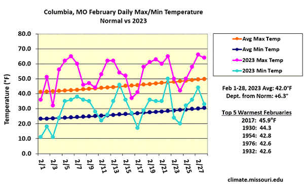
Figure 1.
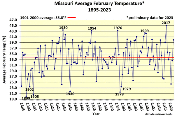
Figure 2.
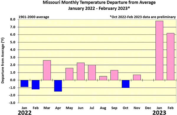
Figure 3.
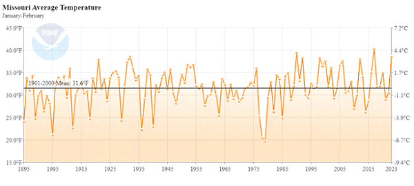
Figure 4.
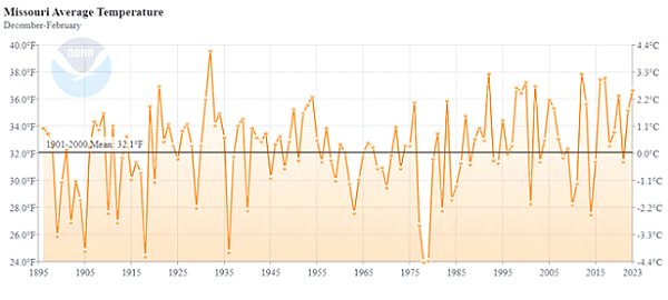
Figure 5.
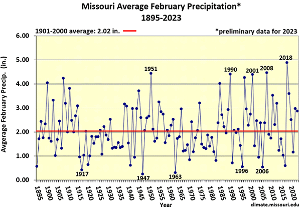
Figure 6.
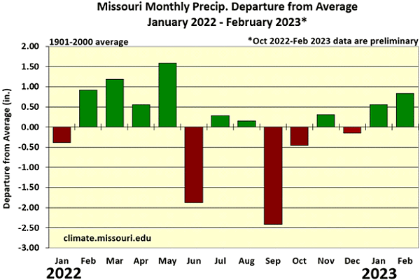
Figure 7.
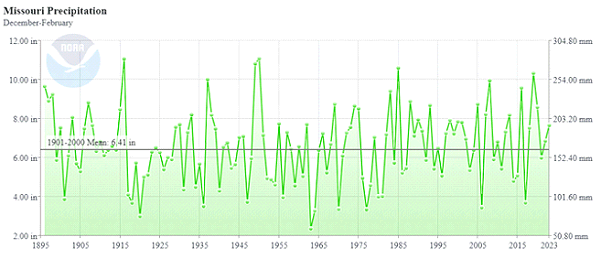
Figure 8.
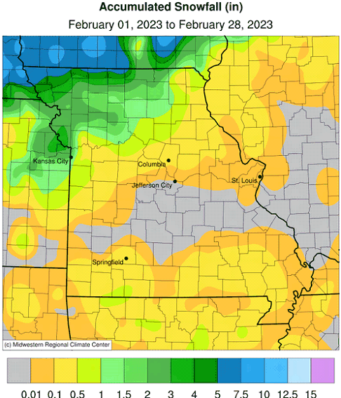
Figure 9.
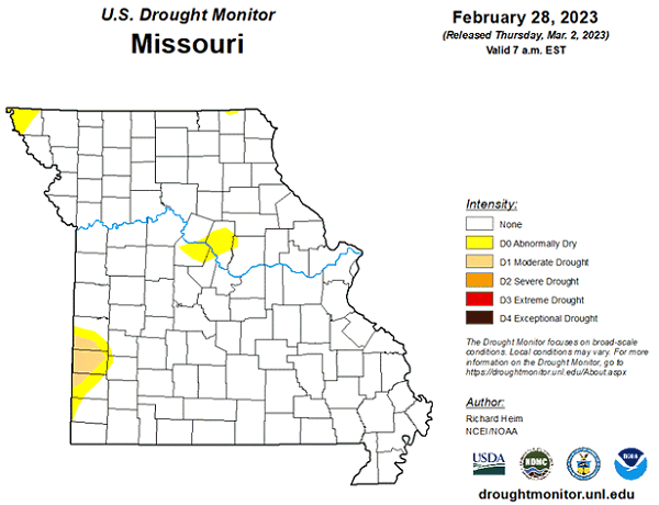
Figure 10.
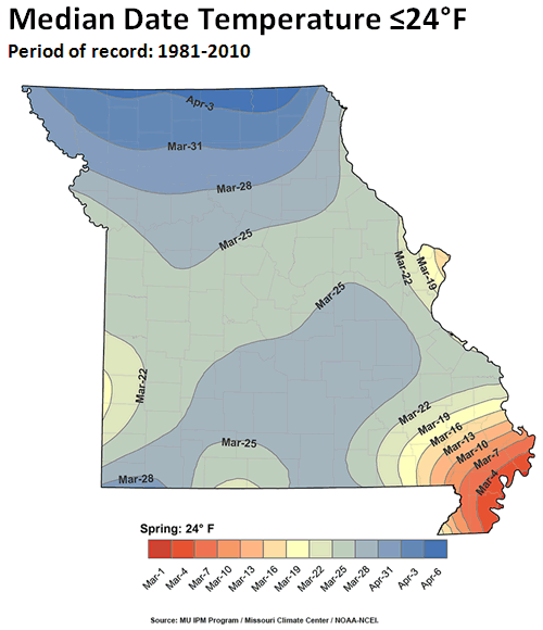
Figure 11.
Source: Pat Guinan, 573-882-5908