May 2012 Weather and Its Impacts on Missouri
Pat Guinan
State Climatologist
Commercial Agriculture/University of Missouri Extension
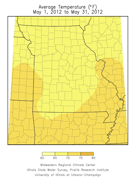
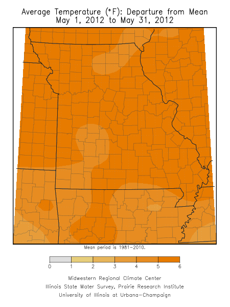
May 2012 marked the 8th consecutive month of above normal temperatures for the Show Me state, with unprecedented warmth impacting the state over the past 12 months. Since June 2011, only September has averaged below normal, and the past winter and spring seasons have ranked 3rd and 1st warmest on record, respectively. Preliminary data indicate May averaged a little more than 5 degrees above normal, and will likely rank in the top 5 warmest Mays on record for Missouri.
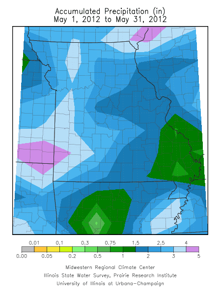
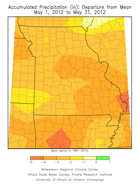
Precipitation was more than 2.5 inches below normal statewide, with preliminary rainfall data indicating a statewide average monthly total of 2.30 inches. According to this total, May 2012 will rank as the 8th driest May on record and the driest May since 2005.
An unusual dry, warm and sunny period impacted the state beginning May 8 through the end of the month. Some locations in northeast, central and east central Missouri went 24 consecutive days (May 8-31) with less than 0.10 inches of rain. Some of the lowest monthly totals were in southeastern Missouri where Perryville and Poplar Bluff reported 0.40” and 0.30”, respectively. Only a handful of counties reported more than 5 inches for the month, which is near average for May. Columbia received 1.31 inches for the month, experiencing its driest May in 101 years, and 3rd driest May on record.
Numerous sunny days, coupled with above normal temperatures and below normal relative humidity led to unusually high moisture loss from soils, water surfaces and vegetation for the month, i.e. evapotranspiration (ETo). These conditions, in combination with lack of rainfall, resulted in a flash drought across much of the state as agricultural and horticultural impacts rapidly emerged. Reports of deteriorating pastures, declining soil moisture reserves, limited stock water supplies, and crop stress increased significantly as the month progressed. Homeowners’ lawns began to turn brown and irrigation was going at a summer like pace in many locations. Several automated weather stations across the state estimated short crop ETo rates of 0.20”/day, and ETo totals approached 6 inches for the month, more typical of summer time.