
June 2014 Weather and Its Impacts on Missouri
Pat Guinan
State Climatologist
Commercial Agriculture/University of Missouri Extension
Wet conditions emerged during June across much of the Show Me state with statewide average monthly precipitation averaging just over 6-inches, or more than 1.5 inches above normal. It was the wettest June since 2008, Figure 1, and the wettest month since May 2013, Figure 2. Monthly totals varied across the state with northern, western and extreme southeastern sections reporting the heaviest rainfall, ranging from 7-10 inches. The rest of the state received 3-6 inches. Some of the heaviest and lightest monthly totals are shown in Table 1. Drought conditions improved across Missouri during June, with long-term moderate drought confined to some southwestern counties as of July 1, Figure 3.
Very heavy June rainfall in the upper Midwest, Figure 4, resulted in significant flooding along the Mississippi River from Minnesota southward to north of St. Louis. Minnesota and Iowa reported the 1st and 4th wettest June on record, respectively.
Using Columbia, Missouri as a midpoint for the state, Figure 5 shows initial warmth for the first few days of the month that transitioned to a cool, cloudy period for several days through mid-month. More than half the days were cloudy during the first half of June, but sunny days, and seasonably warm and muggy conditions dominated during the latter half of June, Figure 6. Preliminary data indicate the average statewide temperature was 73.9°F, or 0.9 degrees above the long-term average. Regionally, north central and east central sections averaged 1-2 degrees above normal for the month, while the rest of the state generally averaged 0-1 degrees above normal. June has averaged above normal for 9 out of the past 10 years in Missouri, Figure 7.
According to the Missouri Agricultural Statistics Service, 86% of the state reported topsoil moisture supplies in adequate to surplus condition by the end of the month. Subsoil moisture conditions improved notably with 71% reported to be in adequate to surplus status. Corn, soybean and pasture conditions were looking promising with 79%, 75%, and 58% in good to excellent condition, respectively. The majority of hay and stock water supplies were also adequate to surplus at 89% and 85%, respectively.
Jump to:
- Figure 1
- Figure 2
- Table 1
- Figure 3
- Figure 4
- Figure 5
- Figure 6
- Figure 7
- Figure 8
- Figure 9
- Figure 10
- Figure 11
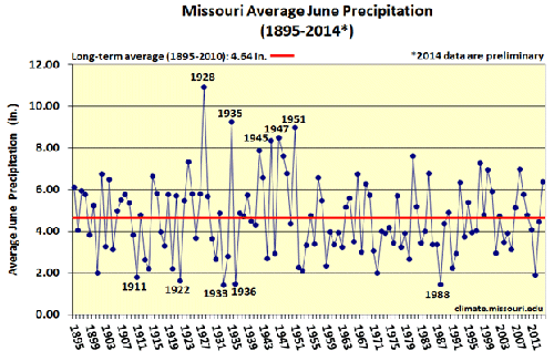
Figure 1.
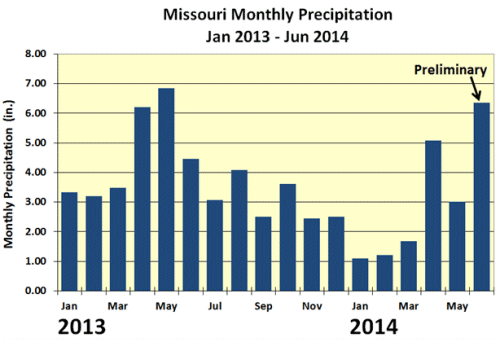
Figure 2.
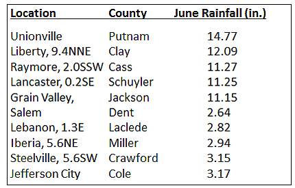
Table 1.
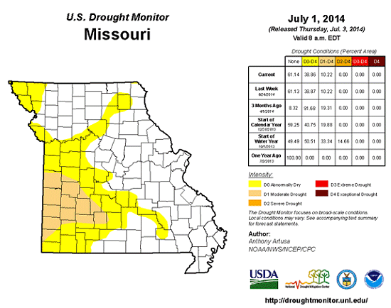
Figure 3.
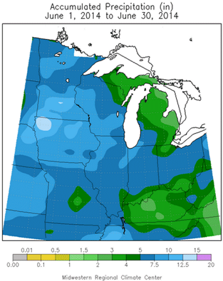
Figure 4.

Figure 5.
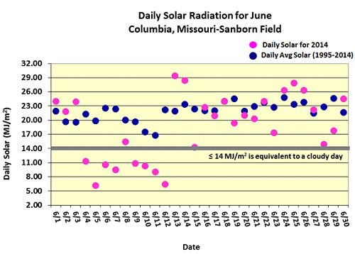
Figure 6.
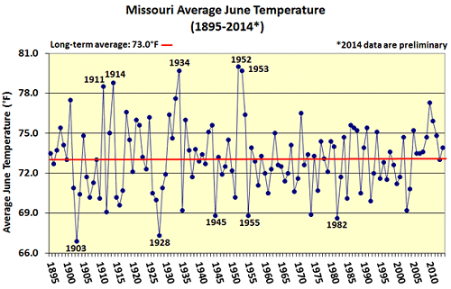
Figure 7.
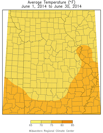
Figure 8.
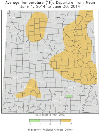
Figure 9.
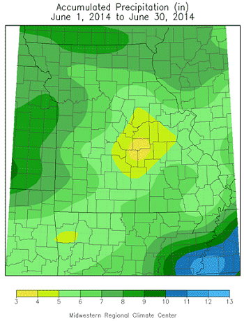
Figure 10.
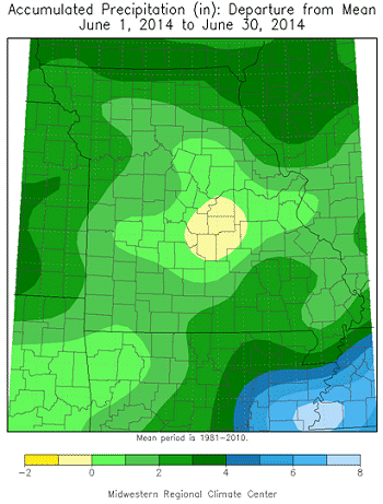
Figure 11.
Source: Pat Guinan, 573-882-5908