December 2018 Weather and Its Impacts on Missouri
Pat Guinan
State Climatologist
University of Missouri Extension
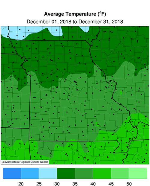
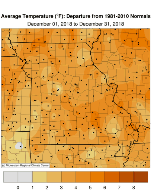
A major weather pattern change, beginning around the 10th of December, translated to milder conditions for the rest of the month, Figure 1. December highly contrasted with the unusually cold conditions experienced in November, Figures 2 and 3. Cold air masses remained in Canada with milder Pacific air masses impacting the country for much of the month. Preliminary data indicate the statewide average December temperature for Missouri was 36.4�F, or 3.4� above the long-term average. It was the warmest December since 2015, Figure 4.
One of the outstanding features of 2018 was the flip in consecutive monthly temperature anomalies, i.e. an unusually cold month followed by an unusually warm month. These conditions were especially notable in April-May and November-December, Figure 5. The monthly extremes were masked in the annual average temperature for 2018, where preliminary data indicate the year was slightly above average, 55.2�F, or 0.6� above the long-term average. Sixteen out of the past twenty-one years in Missouri have been warmer than average, Figure 6.
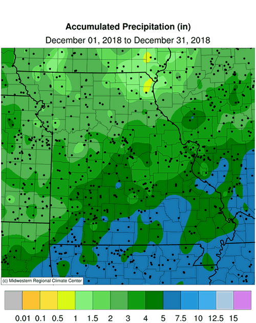
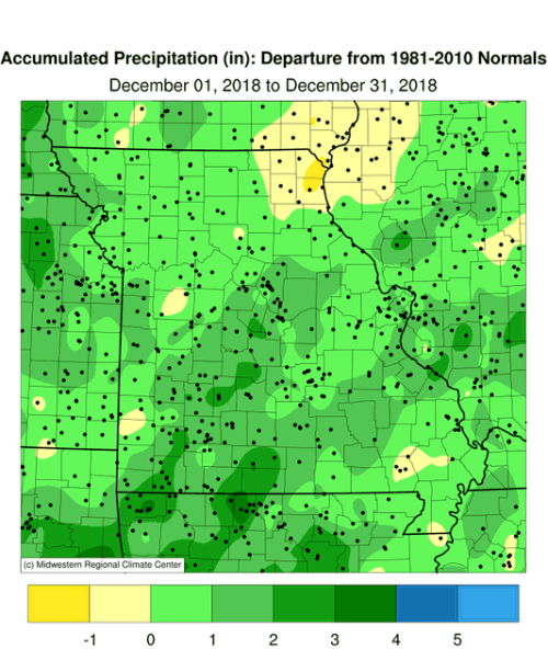
December was a wet month with preliminary precipitation data indicating a statewide average total of 3.71 inches, or 1.37 inches above the long-term average. It was the wettest December since 2015, Figure 7, and the fifth wetter than average month for 2018, Figure 8. There were several significant rainfall events during the month, most notably Dec 1, 13-14, 26-27 and 31. Frozen precipitation events were minimal, with minor monthly accumulations. Many locations across southern Missouri reported no measurable snowfall, Figure 9.
Despite severe to exceptional drought impacting Missouri in 2018, most notably during the growing season, the average annual statewide precipitation was 43.00 inches, or 2.14 inches above the long-term average. The wetter than average conditions follows the wet trend Missouri has experienced over the past few decades, Figure 10. By the end of the year, drought impacted a small area in southwestern Missouri, according to the U.S. Drought Monitor map, Figure 11.
The mild December weather translated to lower than usual energy consumption and consumer savings for the month. The soil profile has been recharged and damp conditions will likely linger for the rest of winter considering cold season temperatures, short day length, dormant vegetation and minimal evaporation rates.
A severe weather event occurred during the early morning hours of December 1 when thunderstorms with strong winds and tornadoes impacted parts of southern Missouri, Figure 12. The National Weather Service office in Springfield, MO surveyed and documented 7 tornadoes during the event, Figure 13. Tree and property damage were reported, and sadly, one fatality was reported in Lawrence County from an EF-1 tornado near the community of Aurora.
Jump to:
- Figure 1
- Figure 2
- Figure 3
- Figure 4
- Figure 5
- Figure 6
- Figure 7
- Figure 8
- Figure 9
- Figure 10
- Figure 11
- Figure 12
- Figure 13
- Figure 14
- Figure 15
- Figure 16
- Figure 17
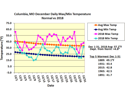
Figure 1.
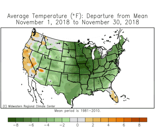
Figure 2.
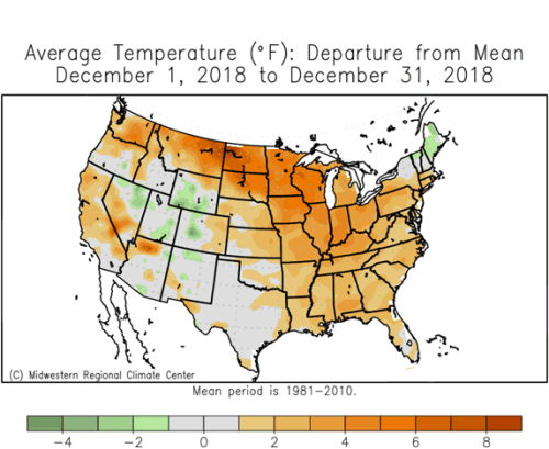
Figure 3.
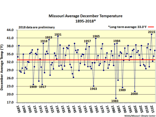
Figure 4.
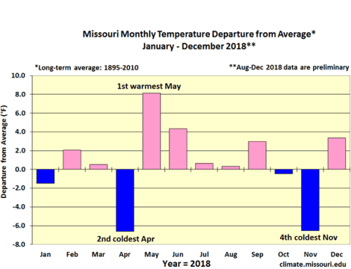
Figure 5.
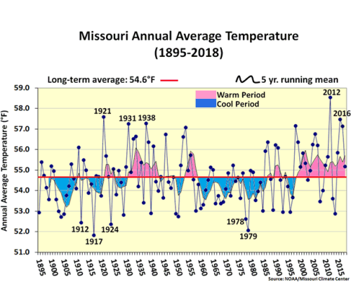
Figure 6.
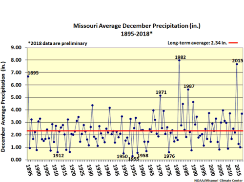
Figure 7.
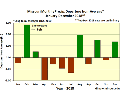
Figure 8.
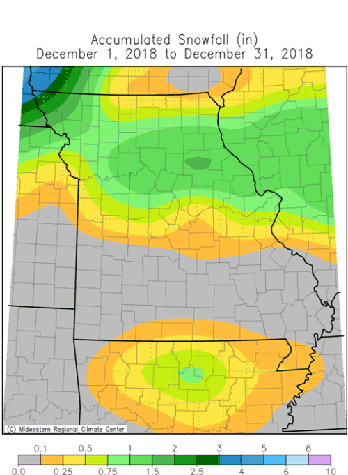
Figure 9.
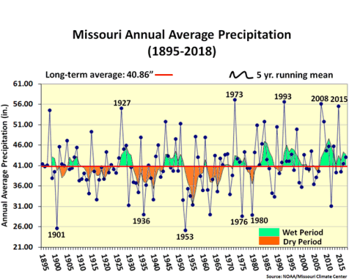
Figure 10.
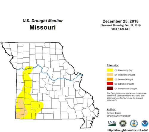
Figure 11.
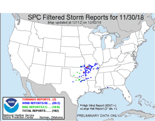
Figure 12.
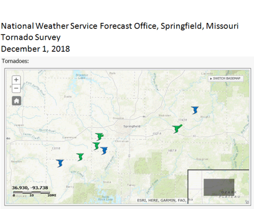
Figure 13.
Source: Pat Guinan, 573-882-5908


