
November 2016 Weather and Its Impacts on Missouri
Pat Guinan
State Climatologist
Commercial Agriculture/University of Missouri Extension
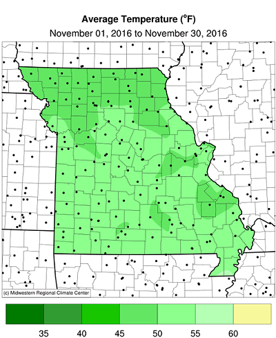
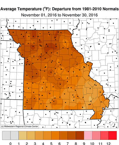
Unseasonably mild fall weather persisted through much of November for Missouri. Preliminary data indicates the statewide average temperature for the month was 50.7°F, slightly less than 7°F above the long-term average. It was the 5th warmest November on record for the state, Figure 1, and the 2nd warmest autumn (Sep-Oct-Nov) in 122 years, Figure 2. Ten out of the past eleven months in Missouri have been warmer than normal, Figure 3, and the year will likely rank as one of the warmest on record.
There were a handful of days when temperatures dipped below freezing, but many days when it climbed above 60°F, Figure 4. Several locations reached the 80s during the first two days of the month and as late as November 17th. The persistent mild conditions extended the growing season 3-4 weeks longer than usual with warm season grasses remaining green and some flowers blooming into mid and late November. Fall colors were delayed by the warm weather. The Columbia Regional Airport experienced its first fall freeze on November 13th, three weeks later than usual. Springfield experienced its first fall freeze on November 19th, nearly a month later than usual. Some locations managed to avoid a hard freeze (≤24°F) for the entire month.
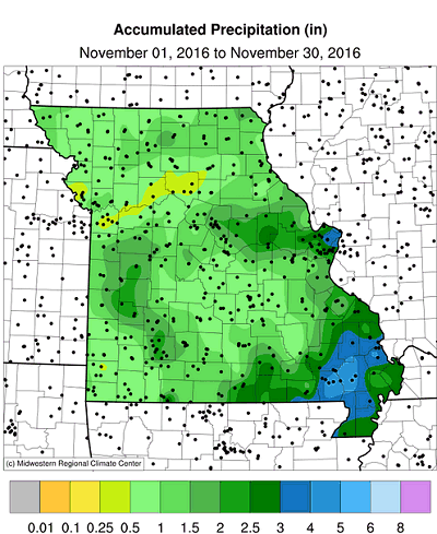
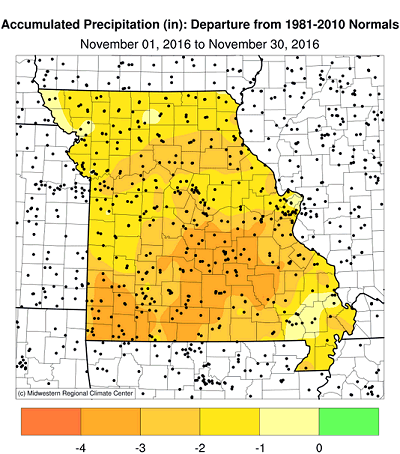
Dry conditions and abundant sunshine prevailed for much of November. Preliminary rainfall data for the month indicate a statewide average total of 1.50 inches, a little more than 50% of normal, and in stark contrast to the extreme wetness experienced in November 2015, Figure 5.
Heaviest monthly totals were confined to southeastern sections where 2 to 4 inches were common. A corridor of 2-3 inches was reported along I-70 from Columbia to St. Louis. With a few exceptions, most of northern Missouri, west central and southwestern sections reported less than 1.5 inches for the month.
Notable rain events during the month include 11/2-3 when parts of central and southwestern Missouri reported 0.5 to 2.5 inches, with localized amounts exceeding 3-inches in east central sections. Another rain event dropped 0.5-1-inch over portions of west central and southwest Missouri on 11/7-8. The northwest corner of the state and southeastern sections received 0.5 to 1-inch on 11/22-23. A heavy rain event impacted southeastern Missouri with 0.5 to 2.5 inches on 11/28.
As of November 29th, the Drought Monitor map indicated abnormally dry conditions over pockets of northern and much of the southern Missouri. Moderate to severe drought was reported over far southeastern sections, Figure 6.
The mild November weather translated to state, county, and consumer savings associated with lower heating demand. As of November 27th, the Missouri Agricultural Statistics Service reported 70% of the topsoil moisture supplies in adequate condition and 72% of the subsoil moisture supply as adequate. Winter wheat was reported to be 84% emerged, 2 percentage points lower than the 5-year average, and 58% in good to excellent condition. All crop reporting districts reported the majority of their hay supplies and other roughages as adequate. Stock water supplies were also mostly adequate statewide.
Jump to:
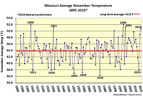
Figure 1.
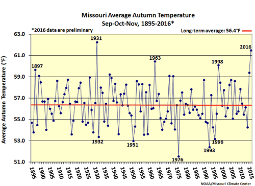
Figure 2.
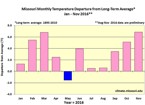
Figure 3.
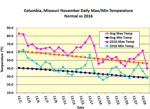
Figure 4.
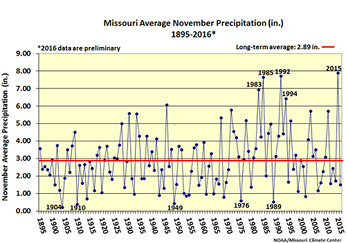
Figure 5.
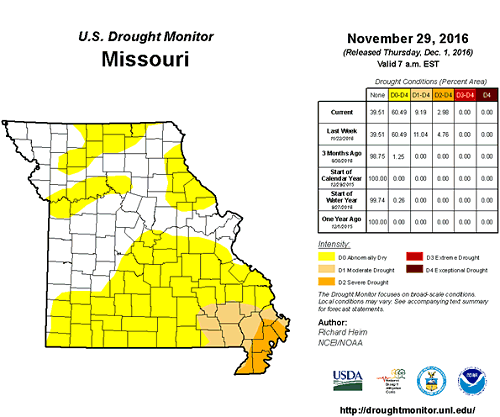
Figure 6.
Source: Pat Guinan, 573-882-5908