
November 2014 Weather and Its Impacts on Missouri
Pat Guinan
State Climatologist
Commercial Agriculture/University of Missouri Extension
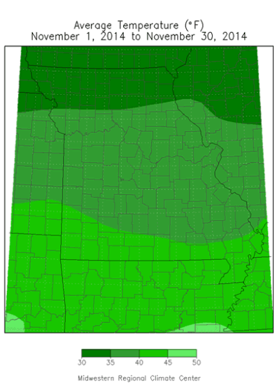
Chilly temperatures reigned supreme during November in what preliminary data are indicating was the coldest November in nearly 40 years. The average statewide temperature was 37.9°F, 6.3 degrees below normal, and the coldest November since 1976, Figure 1. The month tied with 1929 in being the 5th coldest November on record, Table 1.
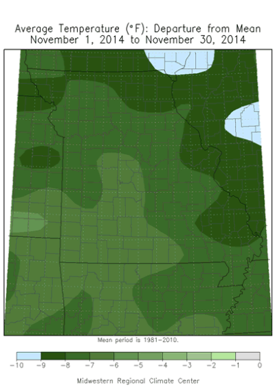
Temperatures were below normal for much of the month, with only a few days managing to climb to 60°F or higher. An arctic air mass settled over the region around mid-month and brought much below normal daily temperatures, 10 to 25 degrees below normal, for more than a week, Figure 2. Numerous minimum temperature records were established on the morning of November 18 when the mercury dipped to single digits across much of the state, Figure 3. Joplin dropped to 6°F on 11/18 and set an all-time minimum temperature record for the month, eclipsing the previous record of 7°F set on November 29, 1976.
The colder than normal November did not deviate from the trend of cool monthly temperatures for the past two years, Figure 4. Preliminary temperature data indicate the January through November period for this year is the 4th coolest on record, and the coolest since 1979, Figure 5.
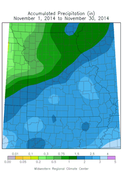
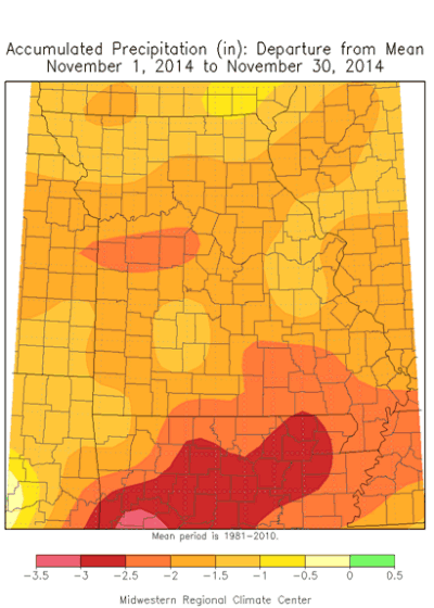
November precipitation was lighter than normal with preliminary data indicating a statewide average of 1.81 inches, or 1-inch below the long-term average. Lightest amounts occurred over northwestern Missouri, generally less than 1-inch, and increased southeastward through the state. Heaviest totals were reported generally along and southeast of Interstate 44, where 2.5 to 3 inches were common.
Some of the lowest monthly precipitation totals were reported in the northwestern tip of the state where Mound City, Maryville and Rock Port reported 0.19", 0.15" and 0.10", respectively. Highest totals were observed in parts of southern and east central Missouri where CoCoRaHS observers in Lawrence, Douglas, Howell, Oregon, Phelps, Franklin, and St. Louis counties reported just over 3 inches.
An early season snow event occurred during mid-month when 0.5-4 inches of snow fell across much of the state, Figures 6 and 7. Heaviest snowfall totals, between 2-4 inches, were reported along a 30-50 mile corridor along and north of I-44, from St. Louis to Joplin, and another band of 2-4 inches occurred over far northern Missouri. The same system brought heavier snow to far southeastern sections of Missouri, including the Bootheel, where 3-4 inches were reported in a band extending from Poplar Bluff to Sikeston to Cape Girardeau, MO.
The dominant cold translated to a frost line in the soil and rural ponds and small lakes freezing over, all unusual occurrences for extended periods of time in November. The cold weather also led to higher energy use among consumers.
Jump to:
- Figure 1
- Table 1
- Figure 2
- Figure 3
- Figure 4
- Figure 5
- Figure 6
- Figure 7
- Figure 8
- Figure 9
- Figure 10
- Figure 11
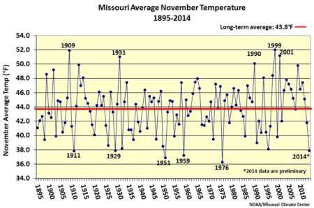
Figure 1.
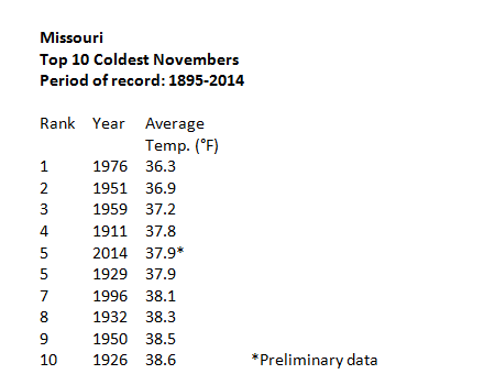
Table 1.
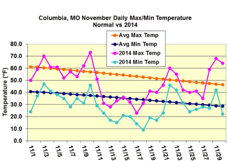
Figure 2.
Figure 3. Minimum temperature records established on November 18, 2014.
Source: NCDC
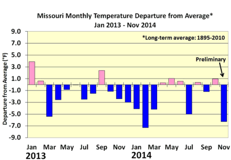
Figure 4.
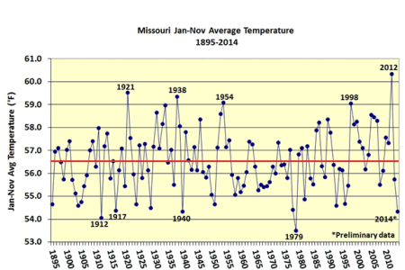
Figure 5.
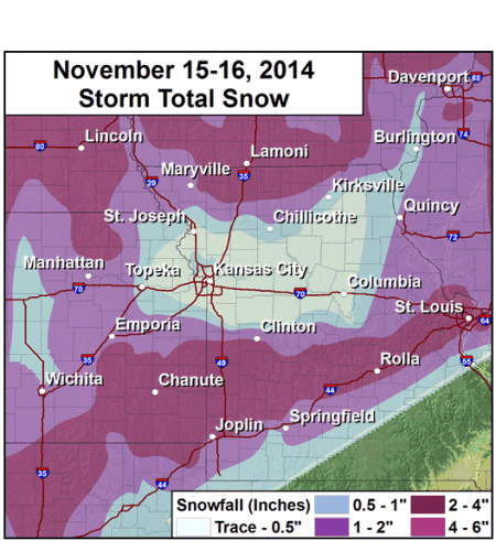
Figure 6. Source: NWS-Pleasant Hill
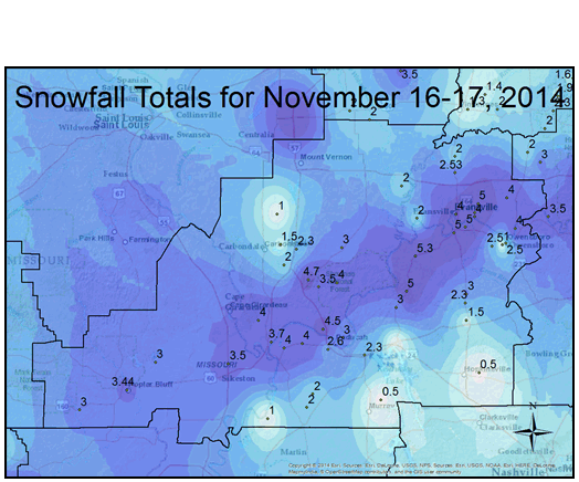
Figure 7. Source: NWS-Paducah
Source: Pat Guinan, 573-882-5908