Missouri Autumn Weather Summary
Pat Guinan
State Climatologist
Commercial Agriculture/University of Missouri Extension
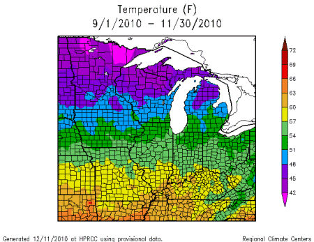
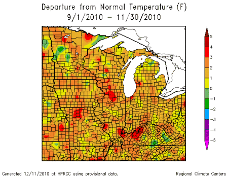
Preliminary numbers are indicating the autumn of 2010 will go down as warmer than normal for all of Missouri with varying amounts of monthly precipitation, ranging from much above to much below normal. Some notable characteristics of this fall were large month to month disparities in precipitation and numerous cloud free days during October.
September, October and November were all warmer than normal averaging 1.0, 1.8 and 2.6°F above normal, respectively. Overall, the average autumn temperature was 57.8°F degrees, or 1.8 degrees above normal. Three consecutive months of above normal temperatures resulted in this fall being the 25th warmest in the past 116 years and the warmest since 2007. Individually, September, October and November ranked as the 33rd, 31st, and 21st warmest on record, respectively.
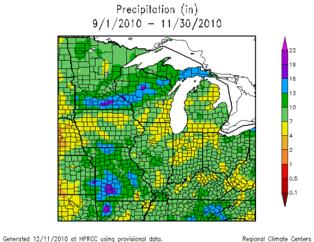
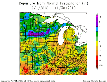
Autumn rainfall was variable across the state from month to month, but overall, statewide average precipitation for September was 7.50 inches, or 3.53 inches above normal. It was the 10th wettest September on record for the Show Me State and the wettest September since 2008. Conditions turned dry in October and total monthly precipitation averaged 0.71 inches, or 2.65 inches below normal. It was the 4th driest October on record and the driest October since 1964. Dry conditions persisted through the first half of November, but a wetter pattern established itself during the last two weeks of the month. November average precipitation was 2.92 inches, or 0.90 inches below normal. The combined autumn average precipitation was 11.13 inches, which is 0.02 inches below the statewide seasonal norm.
All areas of the state experienced above normal rainfall in September with the exception of the Bootheel. Excluding the northwestern tip, the western 1/3 of Missouri reported highest monthly totals between 8-12 inches, whereas the Bootheel averaged less than 3 inches. A few counties in southwestern Missouri reported more than 14 inches of rain for the month. Alternatively, two Bootheel locations, Kennett and Caruthersville, reported less than 1-inch for the entire month.
In October, heaviest monthly totals were confined to some northwestern counties where Maryville and Grant City reported 2.62 and 2.31 inches, respectively. On the other hand, many locations in south central Missouri and the eastern Ozarks received less than 0.30 inches for the entire month. Lowest October rainfall totals were reported in the south central communities of Marshfield and Hartville, where each location reported a scant 0.03" for the month.
November precipitation averaged below normal across much of northern and central sections, as well as portions of far southern Missouri. A few locations across northern Missouri reported less than 1-inch for the month. A corridor of above normal rainfall was located along I-44, from Springfield to St. Louis, and southward from St. Louis to parts of southeastern Missouri. Following an exceptionally dry October, a weather observer near Marshfield, in Webster County, reported 7.16 inches for the month.
According to the National Drought Mitigation Center's Drought Monitor map for November 30th, severe to extreme drought continued to plague the Bootheel region, where significant year end deficits had accumulated. These dry conditions, however, were tempered somewhat when significant rain events occurred toward the end of the month in the area.
As we march through the winter season (December, January, and February), the latest winter outlook from the Climate Prediction Center is calling for above normal temperatures over all of Missouri. Additionally, the outlook calls for above normal precipitation for the southeastern half of the state with the highest likelihood of this occurring over the Bootheel region. Equal chances of above, below, and near normal precipitation are indicated for the rest of the state. Normal precipitation for the winter months in Missouri varies from just under 3 inches in the northwest corner to nearly a foot in the Bootheel.
